
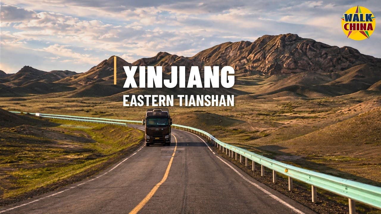


Xinjiang’s Remote Wilderness Road — Into the Wild Heart of the Eastern Tianshan | 4K
3,713
Socialcounts.Org
142
likes
26
comments
daily view 0
monthly view 0
Live Analytics
Comments 0
Xinjiang’s Remote Wilderness Road — Into the Wild Heart of the Eastern Tianshan | 4K Analytics Table
Income Estimates for Xinjiang’s Remote Wilderness Road — Into the Wild Heart of the Eastern Tianshan | 4K
Based on this YouTube video's total view count of 3.71K views and industry-standard rates, the estimated total earning is $3 - $7 through ad revenue. Historical data is not yet available to calculate daily, weekly, or monthly averages.
About Xinjiang’s Remote Wilderness Road — Into the Wild Heart of the Eastern Tianshan | 4K
Explore Xinjiang’s Remote Wilderness Road — Into the Wild Heart of the Eastern Tianshan | 4K with 3,713 views, 142 likes, and 26 comments. Experience the impact of this video content that has captured audience attention.
This immersive drive takes us deep into the rarely seen wilderness north of China’s Eastern Tianshan Mountains. The journey begins at the G335–Y559 junction at XPCC 13th Division Hongshan Farm. We follow Y559 onto Z501 and travel northwest for 78 kilometers, ending near Yingzuishan in Bo’erqiangji Town, Barkol Kazakh Autonomous County, Hami, Xinjiang. After leaving Hongshan Farm, the cultivated fields, grazing land and regiment communities gradually fall behind. The road opens into the vast Barkol highlands, where grassland, semi-arid plateaus, exposed mountains and scattered settlements alternate beneath a cloudy sky. Long, almost empty stretches of asphalt appear to lead endlessly into the Eastern Tianshan. Barkol lies in northeastern Xinjiang on the northern side of the Eastern Tianshan range. With an average elevation of approximately 1,650 meters, the county is shaped by three mountain systems surrounding two major basins. Much of its territory consists of mountains and Gobi terrain, and its cool, dry continental climate brings mild summers, long winters and rapidly changing highland weather. The elevation on this drive ranges from 1,605 to 1,775 meters. There are no extreme continuous climbs, yet the scale of the landscape is enormous. Mountains that appear close may remain on the horizon for a surprisingly long time. Occasional vehicles, pastoral facilities and freight activity also reveal that this is not an untouched no-man’s land, but a working frontier landscape. Hongshan Farm was founded in 1958 and is the only border regiment-level farm administered by the 13th Division of the Xinjiang Production and Construction Corps. Over several decades, farmland, livestock production, residential communities, industry and modern transport have developed together here. The surrounding area is known for wheat, potatoes, sunflowers, cattle and sheep. Z501 is not a road created only for tourism. It connects local settlements, agricultural and pastoral areas, industrial zones and routes leading toward Barkol’s western mining district. It carries both everyday local traffic and production-related freight. As regional mining, manufacturing and logistics expanded, sections of the road were later included in upgrading and reconstruction projects. This video preserves the appearance of Z501 in July 2024, before some of those later improvements. Bo’erqiangji Town was formally established in 2003 and was named after the mountains to its south. The name is commonly interpreted as “grey, jumbled mountains.” The town sits at around 1,612 meters and is closely linked with Barkol’s western mining area. Its wider administrative territory extends north toward the China–Mongolia border, creating a distinctive meeting point of steppe, open wilderness, industrial roads and frontier geography. Barkol is also part of a much older travel corridor. The northern branch of the ancient Silk Road passed through the wider region, while camel caravans, military settlements, beacon towers and frontier trade left lasting historical traces across the northern Eastern Tianshan. Kazakh pastoral traditions, settled farming, Xinjiang folk opera and the culture of frontier reclamation have all contributed to Barkol’s unique identity. Barkol Lake, Barkol Ancient City, Gaojiahu Wetland, Strange Stone Mountain and the ruins of Dahe Tang City are among the county’s better-known attractions. However, this drive is not a conventional tourist loop and does not follow the shore of Barkol Lake. It reveals quieter county roads, working transport corridors and the remote interior that most visitors never see. There is no talking and no music—only the natural sound of the vehicle, tires, wind and surrounding landscape. Put on your headphones, slow down and travel into one of Xinjiang’s rarely seen wilderness roads. Route Information: 📍 Start: G335–Y559 Junction, XPCC 13th Division Hongshan Farm 🏁 End: Near Yingzuishan, Bo’erqiangji Town, Barkol, Hami, Xinjiang 🛣️ Roads: Y559 and Z501 📏 Distance: 78 km 🕒 Driving Time: 1 hour 13 minutes ⛰️ Elevation: 1,605–1,775 m 📅 Date: July 13, 2024 🌥️ Weather: Cloudy If you enjoy driving in China, remote Xinjiang landscapes, wilderness roads, the Tianshan Mountains and immersive 4K travel, subscribe and continue exploring China’s roads less traveled with me. #Xinjiang #ChinaDrive #TianshanMountains #Barkol #WildernessRoad #4KDrive
About YouTube Real-Time View Count
With SocialCounts.org’s view counter, track your YouTube video’s live view count and YouTube likes count in real time with fast, reliable updates.
Watch every YouTube video live view count rise with our real-time YouTube views tracker—built for accuracy and minimal delay.
Follow YouTube real time views as they happen, using our dedicated view counter for YouTube videos.
Get up-to-date live view count on YouTube and see real-time growth with SocialCounts.org’s smart tracking tools.
Embed Widget
Parameters:
fullscreen=true- Fullscreen countergraph=true- Live graph chartcounter=0/1/2- Select counter (0=likes, 1=views, 2=comments)
URL
Click to copy the embed URL to your clipboard